
Search a Jackson County Street
Begin a street-by-street search with the county version of the address. A property record can identify the parcel and show an owner or mailing address as recorded, but it cannot establish that every named person lives there. The map, deed index, election jurisdiction, and historical directory each add a dated layer. Keep the source and date with each result. That habit prevents a current parcel field from being confused with an old directory listing or a recorded title party.
Use the address trail in order. If a step produces no result, preserve the spelling and move to the next county or municipal route rather than guessing at a household.
- Enter the normalized address in the county property search and save the parcel number, situs address, legal description, and district fields.
- Open the parcel map, inspect the parcel boundary and nearby roads, then open adjacent parcels one at a time when the block context matters.
- Use the legal description, subdivision, lot, or block in the recorder index. Search recorded parties in both grantor and grantee directions.
- Check the appropriate election jurisdiction for registration information or a lawful records request. Kansas City corporate limits use a different election board from the rest of the county.
- For a historic address, ask MGC or KCPL for the right city, year, reel, and page. Scan neighboring entries before drawing a conclusion about a move.
Ownership, a mailing field, and a listed address are separate facts. The Jackson County street directory process works best when the record type is named before the result is interpreted.
Normalize a Jackson County Street Address
Jackson County Property Info asks for a house number, any directional, street name, city, and ZIP. The county directs searchers to omit the state and punctuation after street types or directionals, use standard abbreviations, and enter house-number digits one at a time while waiting for suggestions. That supplied form is the better starting point than an outside map label.
An unsuccessful address is still useful evidence. Test one change at a time: remove a directional, change a street type to the county form, confirm city and ZIP, remove a suite or apartment, try the parcel number, or return to the map. A legacy label, a new split, a rural route, a municipal boundary, or a typo can all produce a no-hit. Record the variants tested.
- Parcel
- A county land unit used to connect a map, assessment fields, and a legal description.
- Situs address
- The physical property address shown by the county, which can differ from an owner mailing address.
- Plat
- A recorded map of a subdivision or tract that can help relate a lot and block to a current parcel.
- Criss-cross directory
- A street-ordered directory section that can turn an address into a historical name lead. MGC should confirm a Jackson County title, year, and format before use.
The Property Info search screen shows the county’s address instructions before a query is run.
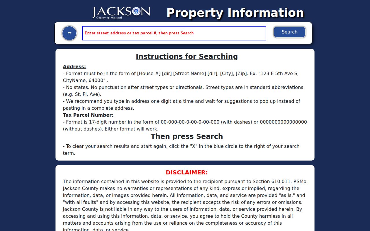
Follow the suggested county form, then preserve it beside any older street label found in a directory, deed, plat, or municipal record.
Note: A county-form address improves matching, but it does not prove a current occupant or erase an earlier street label.
Jackson County Street Directory Property Fields
The Jackson County Public Property Portal searches real and personal assessment records by street address, parcel ID, and other methods. Its property cards can show the parcel, situs address, lot size, building and land-use fields, tax-code area, exemption, legal description, owner and address as shown, other owner blocks, values, districts, and available print or export actions. The county says cards change as records change and are not certified legal instruments.
The July 2025 launch is a helpful current gateway, not a complete historic ownership file. The Values tab announcement refers to 2022 and 2025 values, while the portal itself can change. Use the card to form a precise street question, then verify title with a recorded instrument and tax details with the responsible office.
The Public Property Portal entry screen is the official starting point for this Jackson County street directory step.
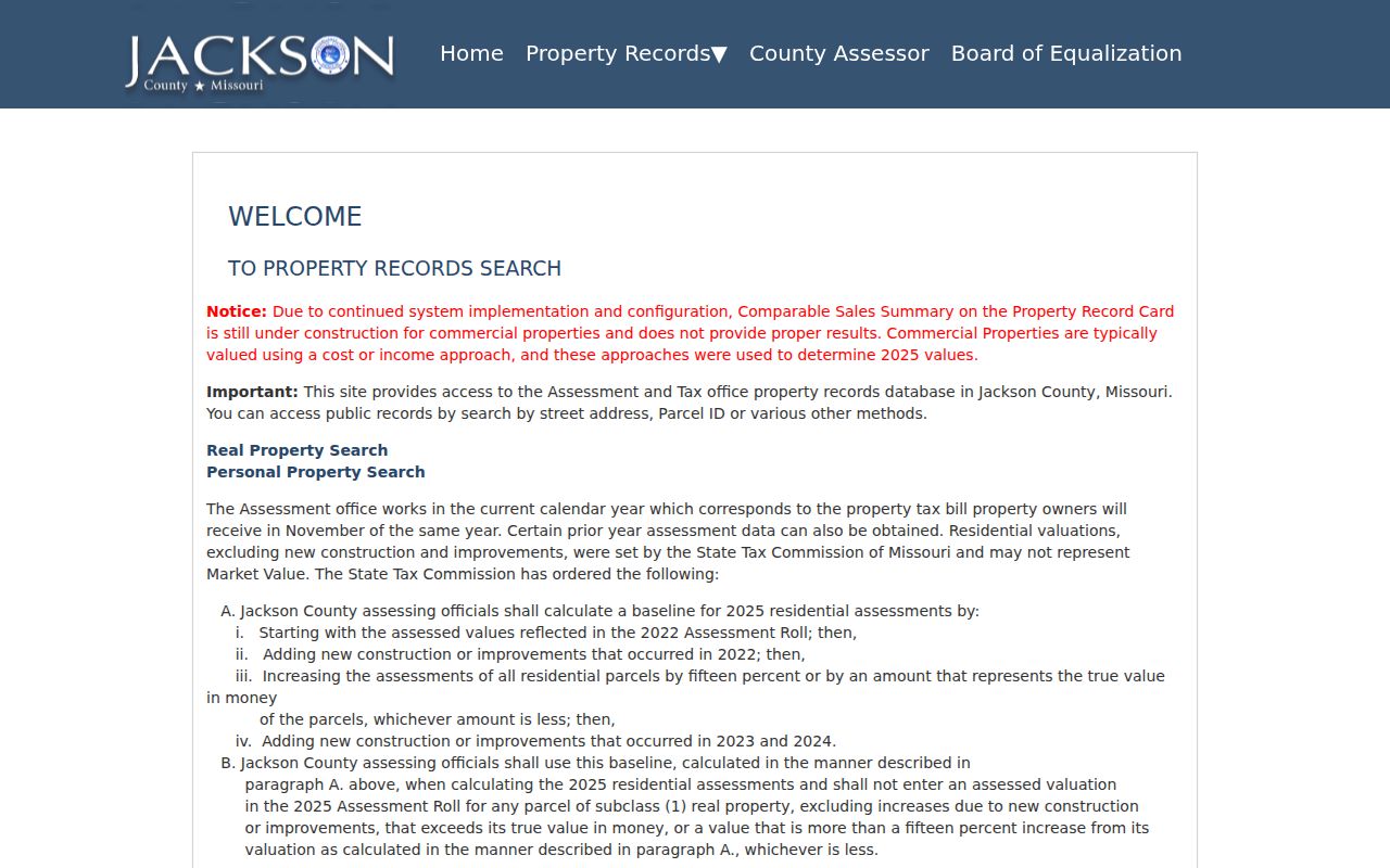
The screen leads to assessment information. It does not replace the Recorder’s title record or prove that a named owner occupies the site.
Map a Jackson County Street Parcel
The Jackson County Parcel Viewer adds the map layer missing from a plain property-card search. After its public disclaimer gate, it can expose parcel and address details, lot size, building and land-use fields, tax code, exemption, legal description, values, owner blocks, districts, TIF information, map and PDF actions. The viewer also lists school, library, fire, and water districts, which are address-level overlays rather than street-wide assumptions.
Map proximity is only a spatial lead. Open each adjacent parcel separately and do not infer an occupant from the lot next door. A subdivision, lot, block, road centerline, or municipal edge can explain why the same street has different district or city labels along its length.
The Parcel Viewer begins with an acknowledgment before the public map tools are available.
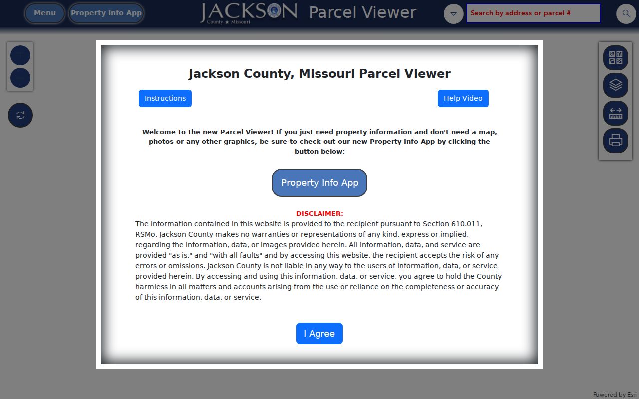
Once open, the map supports parcel-by-parcel comparison. It is not a block roster and should not be read as one.
Trace a Jackson County Street Deed
The parcel’s legal description gives the deed search its strongest anchor. Aumentum’s real-estate index offers combined or separate name modes, grantor and grantee fields, filing dates, instrument and book/page ranges, document type, subdivision, lot, block, and condominium fields. The research capture displayed a permanent index from January 1, 1962, with images from that date, plus a temporary current index. Those displayed dates are dynamic and should be rechecked in the live portal.
Search the current recorded party as grantee, then search that party as grantor to work backward. Keep the instrument number, recording date, book and page, document type, grantor, grantee, and legal-description clue together. A deed, release, easement, plat, lien, judgment, or probate-related instrument serves a different purpose. An index hit is a recorded document lead, not a full explanation of title or occupancy.
The Jackson County Recorder of Deeds is the local route for post-1970 Recorder records, certified copies, and questions about record custody. The office does not perform telephone searches. For a tax-account cross-check, the Collector tax search accepts a PIN, primary owner, property address, or mailing address and caps results at 200, so a full street name or narrower term helps.
Jackson County Street Labels Change
Jackson County includes Kansas City, Independence, Blue Springs, Lee’s Summit, Raytown, Grandview, Grain Valley, Oak Grove, Sugar Creek, and smaller communities. An older source may use a post-office town, village, township, or later-annexed place instead of the city label used today. The county’s two-seat history, with Independence and Kansas City, is another reason that offices and labels do not all line up in one place.
There is no documented countywide street-renaming index in the research. When a historical number or street name does not match, ask the municipality that created the record for planning, public works, addressing, council, plat, or ordinance material. Kansas City’s development-process guidance describes notices to nearby property owners and registered neighborhood groups for certain projects, which can provide a dated parcel and street-history lead. It is not a list of residents.
For ZIP recognition, use the USPS ZIP Code Lookup. It offers address-to-ZIP, city/state-to-ZIP, and ZIP-to-city modes, and specifically warns that a ZIP result does not prove a person or organization occupies an address.
Jackson County Street Records by Source
Several sources can be searched by address or tied back to one. Their names and limits matter. The table separates current parcel information, recorded land instruments, historic listed addresses, and municipal street-history material so a result is not asked to prove more than it can.
| Street record | Jackson County keeper | Address-linked fields | Best access route |
|---|---|---|---|
| Property card | Assessment/Public Property Portal | Parcel, situs, legal description, owner and mailing fields as shown | Public portal; assessment contact |
| Parcel map | GIS Parcel Viewer | Boundary, adjacent parcel IDs, districts, lot/block, TIF | Public viewer after disclaimer |
| Recorded instruments | Recorder and Aumentum | Grantor, grantee, filing date, book/page, type, legal description | Online index; Recorder copy route; Archives for older series |
| Tax account | Collector | PIN, property and mailing address, primary owner | Online search; Collector contact |
| Historical listing | MGC, KCPL, JCHS | Name, address, directory year, page, map or assessment lead | Catalog, microform, archive appointment, or library database |
| Street change or planning record | Creating municipality | Addressing, ordinance, plat, meeting, or project detail | Municipal counter or Sunshine request |
Election information is also jurisdiction-specific. Jackson County Election Board voter information serves county voters outside Kansas City corporate limits, while the state’s Missouri Voter Outreach provides a matching registered-information route. Use the correct board and treat any match as a dated registration record, not an occupancy finding.
Jackson County Street Directory Access Routes
A current online result is not the end of a street search. Nineteenth-century deed books may be on microfilm, and the local collections are not all digitized. The Midwest Genealogy Center catalog and microform guides cover city directories, phone books, county material, and staff-mediated microform loans. Ask for the exact title, year, roll or fiche, and page sequence. The research did not identify a confirmed Jackson-specific reverse-directory run, so ask MGC to check its catalog and uncataloged guides instead of assuming a title exists.
KCPL Missouri Valley Special Collections offers a local-history index, maps, city directories, yearbooks, a 1940 Tax Assessment collection, and historical newspaper leads. Jackson County Historical Society has appointment-only archive research at the Historic Truman Courthouse, with donated holdings that can include abstracts, plats, maps, deeds, city directories on microfilm, and local papers. Ask the archivist for a collection, box, folder, reel, or page rather than a broad name search.
For historic county series, the Missouri State Archives county-record database can be browsed by county, office, record type, keyword, city, and year range. It is an inventory and access route, not a universal online name index. A counter visit, a phone or email routing request, a mail copy request, or an appointment may be the practical next step.
Note: Older street evidence needs a repository and page or reel citation, because a catalog entry alone does not establish a household.
Jackson County Street Directory Update
The county’s 2025 Public Property Portal launch makes address-led work easier, yet the interest layer here is the limit as much as the convenience. The portal provides current and selected prior assessment information, but the county describes its card as informational rather than certified. A recorded deed or a certified copy is a different product with a different custodian and purpose.
That distinction also helps with historic streets. A directory can place a household at a printed address for a year, while a parcel card can show present assessment fields, and a deed can identify recorded parties. When the goal shifts from a historic volume to its reading conventions, use the Jackson County city directory collections rather than trying to recreate that shelf from a property search.
Jackson County Street Directory Limits
A street directory cannot turn public address fields into a complete roster. A property card may show a recorded owner and mailing address, not every person at the situs address. A deed proves a recorded instrument, not continuous residence. A historic directory is a publisher’s dated observation. Protected records and substitute addresses also mean that a missing result can be intentional rather than an error.
Missouri Safe at Home provides a substitute-address program for qualifying survivors and household members. Agencies must accept the substitute address for new records, and older public material may still contain a previous address. Do not try to reverse-engineer a protected location. For a record held by a government custodian, a targeted written request under the Missouri Sunshine Law should name the office, existing record, time span, preferred format, and fee cap.
Lawful use. Jackson County street and parcel records support personal research, family history, property questions, and civic transparency. Never use an address trail to stalk, harass, intimidate, or harm anyone.